GeoStabilizaton expands its capabilities, making monitoring/mitigating geohazards focus of new data-focused work group.

GeoStabilization International of Commerce City, Colo.—a geohazard mitigation firm specializing in emergency landslide repairs, rockfall mitigation and grouting using design/build and design/build/warranty contracting—announced the formation of the company’s new Geohazard Asset Management and Monitoring (GAMM) group. The new group adds to GeoStabilization’s suite of end-to-end solutions by offering data collection, interpretation and analysis of natural hazards in real-time to provide a better understanding of risk and preparation for geohazard potential.
Monitoring/mitigating geohazards
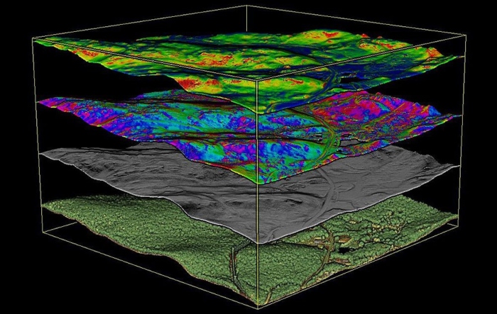
As many engineers know, landslides, rockfalls and other natural hazards can happen at a moment’s notice and often occur without warning—causing devastation and costly repairs. The GAMM team collects and processes many types of geospatial data, including photogrammetry, LIDAR, InSAR, ground-based radar, in-ground instrumentation and orthoimagery to monitor previous and current ground movement and identify concerning trends. With proprietary analytics, the team leverages the data to evaluate and model the measurement of geohazard frequency, intensity and severity. The ability to collect and interpret critical geospatial data in a robust and scalable way is an important way of monitoring/mitigating geohazards by mapping and paying attention to at-risk areas. Combining this capability with GeoStabilization’s experience in slope stabilization helps clients proactively detect, monitor, manage and mitigate geohazards that affect their assets and the public.
“Over the last 20 years, we have worked closely with customers to mitigate thousands of geohazards,” says Daniel Lines, vice president, corporate strategy and development at GeoStabilization International. “Throughout that time, we observed that most have more geohazards to mitigate than their budget allows, forcing them to react only after a failure occurs. It pained us to repeatedly witness this scenario, so we began building our capability to gather and analyze data to assist our customers in prioritizing the mitigation of their geohazards. . . . By utilizing geospatial data, the GAMM group proactively monitors changes, detects early warning signs and provides risk management through meaningful analysis. With this information, we can better help our customers make proactive, consistent and fiscally responsible decisions regarding geohazards that threaten their communities and assets.”
“By utilizing geospatial data, the GAMM group proactively monitors changes, detects early warning signs and provides risk management through meaningful analysis. With this information, we can better help our customers make proactive, consistent and fiscally responsible decisions regarding geohazards that threaten their communities and assets.”
Daniel Lines, vice president, corporate strategy and development, GeoStabilization International
GAMM experts brought on board
With the expanded company capabilities, the new group has added additional geology and data analysis experts to GeoStabilization, including:
Lex Ivey, who serves as director of data science and analytics for GAMM. In this role, Lex leverages remote sensing and geospatial data science to give GeoStabilization more proactive capabilities in protecting people and infrastructure from the dangers of geohazards. Ivey has more than two decades of pioneering, innovating and elevating real-world applications of geospatial technology and decision support.
Ben Haugen, who serves as the director of business development for GAMM. Haugen leads GeoStabilization’s efforts to drive customer awareness and project development to the remote sensing, instrumentation and monitoring business market. A geological engineer, Haugen brings to the company extensive knowledge and more than a decade of experience in geohazard monitoring, analysis and mitigation.
Cody Stopka, project development geologist for GAMM. Stopka helps lead the development of the group’s capabilities and supports GeoStabilization market sectors across North America. With a background in structural and field geology, Stopka has in-depth experience proactively monitoring geohazards to ensure the safety and functionality of open-pit mines, large landslide complexes and debris flow hazards.
The GAMM group furthers GeoStabilization’s ability to provide the best value to customers through comprehensive monitoring and data analytics for decision support and customized design-build mitigation services. By diversifying its portfolio of services to include real-time data collection and analysis, the company can more precisely predict and plan for geohazards—providing added protection to people and critical infrastructure.
For more information on the GAMM group’s capabilities, visit GAMM online.
 TEXTILES.ORG


